East Side Mining District – Stumptown Loop – Groomed Winter Trail
Trail Name: Stumptown Loop
Distance: 3.5 miles
Elevation Gain: 11,000’ – 11,400’
Activities: Motorized and non-motorized: Nordic ski, fat bike, snowshoe, snowmobile, snow bike
Equipment: Rent equipment in downtown Leadville
Cost: Free
*
Conditions: The High Riders Snowmobile Club posts when they groom the East Side Mining District
TRAIL MAP (interactive map / printable map).
Check our Colorado Backcountry Winter Safety Resources, especially if you are exploring off-trail in the East Side Mining District.
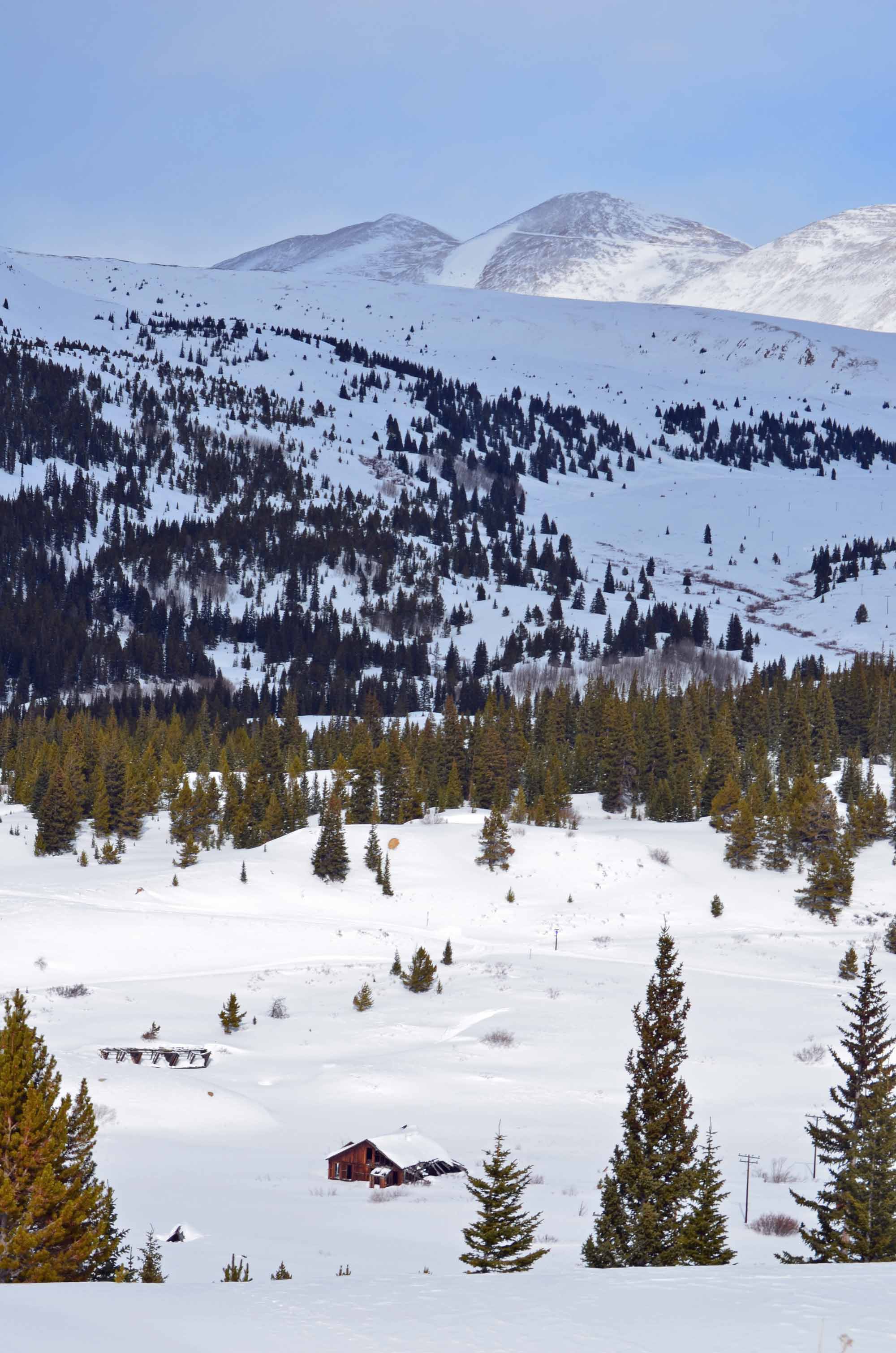
Why It’s a Gem
You’ll start near trees, wind through the East Side Mining District, and climb to a high open area with magnificent views. Along the way are a couple of long uphill climbs and steep downhills, for variety. You’ll pass the remains of cribbing, mining shacks, and other structures from the 1880s silver rush. At the top of the hill, look for the short metal headframe of the Hopemore Mine, which sometimes is open for underground tours in the summer. Or feast your eyes on the Mosquito Range rising over 13,000’ to the east.
Directions to Trailhead
From Harrison Ave. in downtown Leadville, follow 7th Street (same as County Road 3) east about 4 miles. Park where plowing ends.
Parking
From Harrison Ave. in downtown Leadville, follow 7th Street (same as County Road 3) east about 4 miles. Park where plowing ends. There is a small lot and room on the sides of the road. Please do not block County Road 3, so that snowmobiles and grooming machines can get through.
On-Trail Directions
From the parking area, head south on County Road 3, continuing south on County Road 3B at the first intersection.
As you emerge from the trees, head east (left) on County Road 38. Follow it between tall piles of mining tailings, then off to the right at a four-way junction. A long sloping horseshoe will bring you to the top of Breece Hill, where you’ll head west (right) on County Road 1.
As you head down the hill and back into the trees, make a hard right on County Road 38A as it comes uphill at a sharp angle. At the bottom of the hill, turn east (right) for a short jog on County Road 38, then head north (left) on County Road 3B to complete the loop. At the next intersection, keep straight onto County Road 3 for the short distance back to the parking area.
The History
Pause at the four-way junction on County Road 38, and you’re surrounded by old mines. The Ollie Reed Mine lies 250′ west of the sign and produced everything from lead-silver-zinc ore to gold. Up the slope to the southwest of the sign are the Favorite, Little Ellen Incline, and Silent Friend mines. Lead-silver blankets were pulled from them from the late 1870s to the 1890s. The Silent Friend was an important source of oxidized zinc ores from 1910 until 1924.
But the ore from these mines wasn’t brought to the surface here. Instead, it was hauled underground through the Yak Tunnel. The tunnel also drained water running from multiple mines and emerged to sunlight 3.5 miles away, in California Gulch, near where the Mineral Belt Trail crosses Toledo St.
As you proceed on the horseshoe of County Road 38, you’ll wind around a ghost town called Stumptown. Only two buildings are still standing; it used to have homes, saloons, a dance hall, and a one-room schoolhouse. Legend has it that Margaret Tobin Brown, also known as The Unsinkable Molly Brown of Titanic fame, lived in Stumptown when she and soon-to-be-wealthy miner J.J. Brown were first married. While living here, she is said to have lost a fortune by hiding paper money too close to a stove, sending her dollars up in smoke.
Was this town, built to support the nearby mines, named for a Joseph Stumpf? Or because of the many stumps chopped off a couple feet above the ground, the remains of trees miners used in the mines and nearby buildings? History buffs are stumped.
On the left side of County Road 38A, you’ll pass remnants of a mine on the Eliza Claim. Near the bottom of the hill and just off the road are more mining structures, near where the now-blocked St. Louis Tunnel once came out of the hillside, bringing the riches of Leadville to light.