This 11.6 mile loop around Leadville has various access points. The main trailhead is at the bottom of Dutch Henry Hill. Head south from the downtown Harrison Avenue/Hwy 24, following the curve of Hwy 24. Drive past the entrance to Colorado Mountain College and shortly after turn left into the dirt lot where you can see where the paved trail cross the road across from the car wash.
The main trailhead parking is a dirt lot at the base of Dutch Henry Hill, south of downtown Leadville on Hwy 24.
Additional access locations with parking include:
- 6th & McWethy Drive (parking at Community Field or Intermediate/High School lots)
- Ice Palace Park – 11th Street & Harrison Avenue
- East 7th Street – approximately 1.25 miles from Harrison Avenue go under the metal foot bridge and park in the pullout to the left
- East 5th Street – approximately 1.25 mile from Harrison Avenue turn left just before the metal foot bridge goes over the road into a dirt parking area with historic structures
- California Gulch/County Road 2 – pullout along paved road just before Mineral Belt Crossing
- County Road 6/Landfill Road – Dirt parking area shortly before Landfill entrance
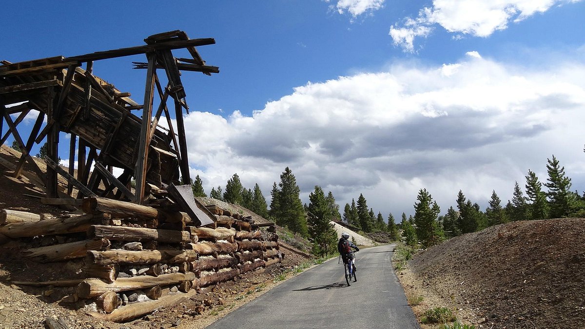
This trail loops the city of Leadville, traveling aspen groves, conifer forests, wildflower meadows, open vista sage parks. It offers unsurpassed views of the Sawatch and Mosquito ranges.
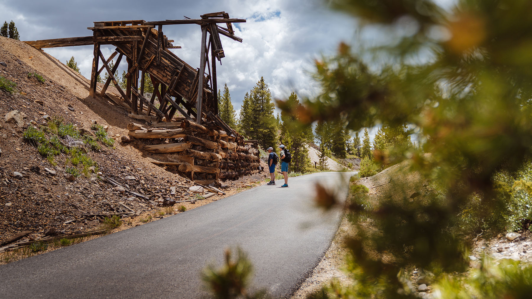
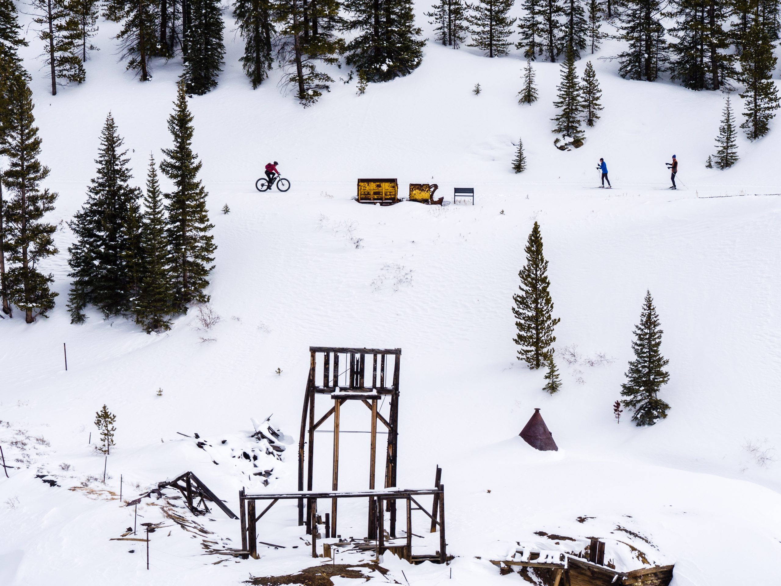
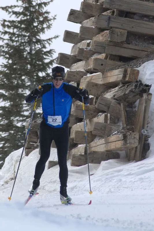
Approximately six miles meander through the historic Leadville Mining District. Interpretive signs give you a sense of Leadville’s rugged mining history—and the chance to stop and catch your breath! You’ll have the rare chance to roll or glide right by original mining structures from as far back as the 1880s. Imagine seeing Silver Rush headframes, cribbing, and tailing piles rising above the snow!
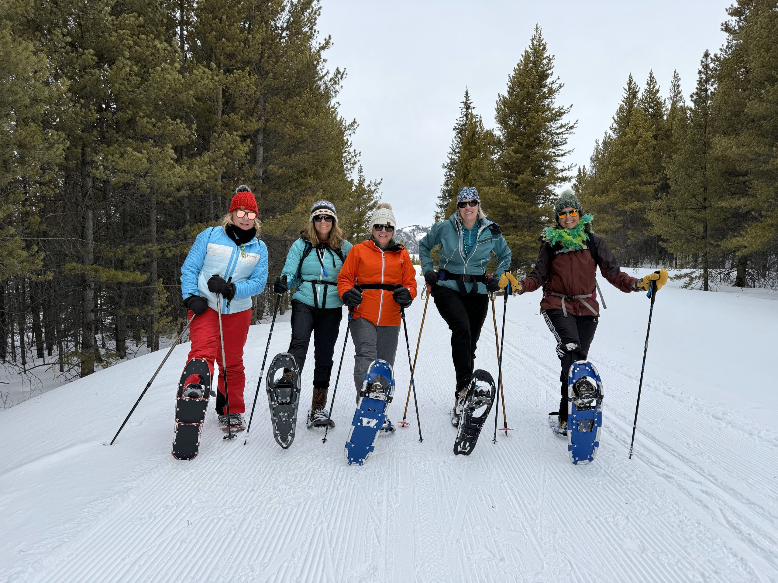
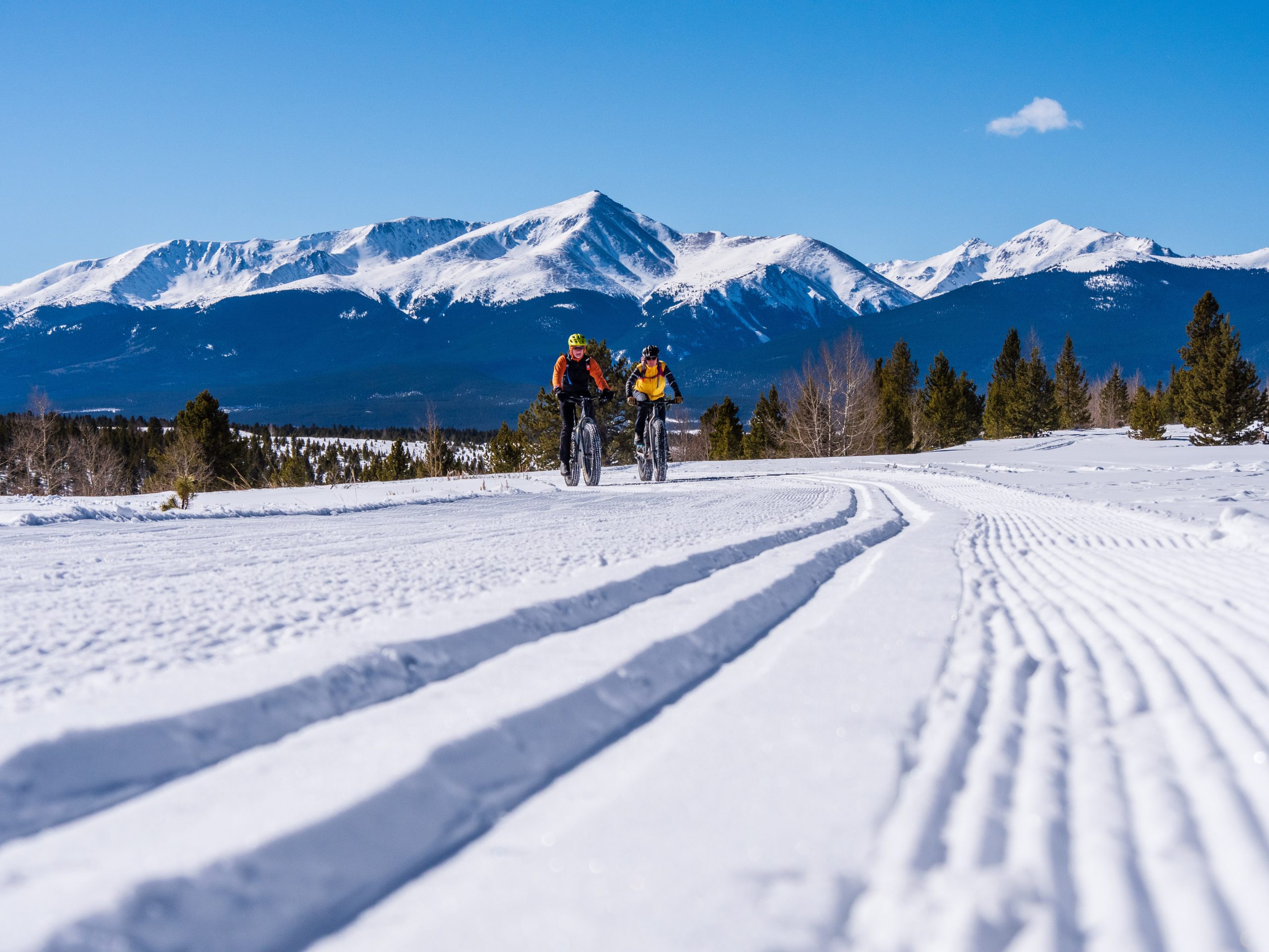
This multi-use trail welcomes hikers, bikers and runners in the summer and fall and Nordic and skate skiers, snowshoers, fat tire bikers in the winter. Trailhead signs and the trail map show which part of the groomed track to travel to find the best surface for you. Need a place to sit for a while or to step out of a chilly breeze? Shelters are located after mile markers 3, 5, 7, and 10 (see the trail map).
The route is also accessible under the Americans with Disabilities Act. With numerous trailheads around town to let you choose your distance, the Mineral Belt Trail is perfect for people of all ages and ability levels. Class I and II eBikes are permitted.