From Harrison Avenue drive up East 7th Street it will change from paved to gravel road becoming County Road 3. Drive east about 3 miles, where County Road 38 splits to the right (groomed and not driveable in winter), a wooden sign marks the former town of Evansville. Park here in the small turnaround or on the sides of the road.
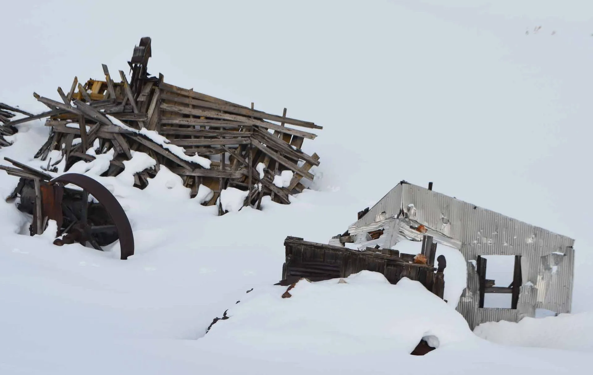
A favorite for skate skiers who want a challenge, this loop is great for anyone who’s a fan of steep uphills and downhills. Even under winter snows, you’ll see mining structures peeking from the drifts. Check out the mining supports called cribbing, giant tailings piles, tall headframes, the two remaining roofs in the ghost town Stumptown, and more. Imagine how hardy the miners of the late 1800s must have been to survive winter in such a place.
From the parking area, head east on County Road 38 for a long, moderate climb through stands of evergreens. As you come into a wide, open area, you’ll begin to see mining structures. Continue east, passing a groomed trail coming in from the right (38A) and another from the left (3B).
You’ll pass a tall cone-shaped pile of mining tailings on your right. Then you’ll reach the third intersection, a four-way junction, and turn southeast (right) to stay on County Road 38. Pause at the four-way junction and you’re surrounded by old mines. The Ollie Reed Mine lies 250′ west of the sign and produced everything from lead-silver-zinc ore to gold. Up the slope to the southwest of the sign are the Favorite, Little Ellen Incline, and Silent Friend mines. Lead-silver blankets were pulled from them from the late 1870s to the 1890s. As you proceed on the horseshoe of County Road 38, you’ll wind around a ghost town called Stumptown. Only two buildings are still standing; it used to have homes, saloons, a dance hall, and a one-room schoolhouse.
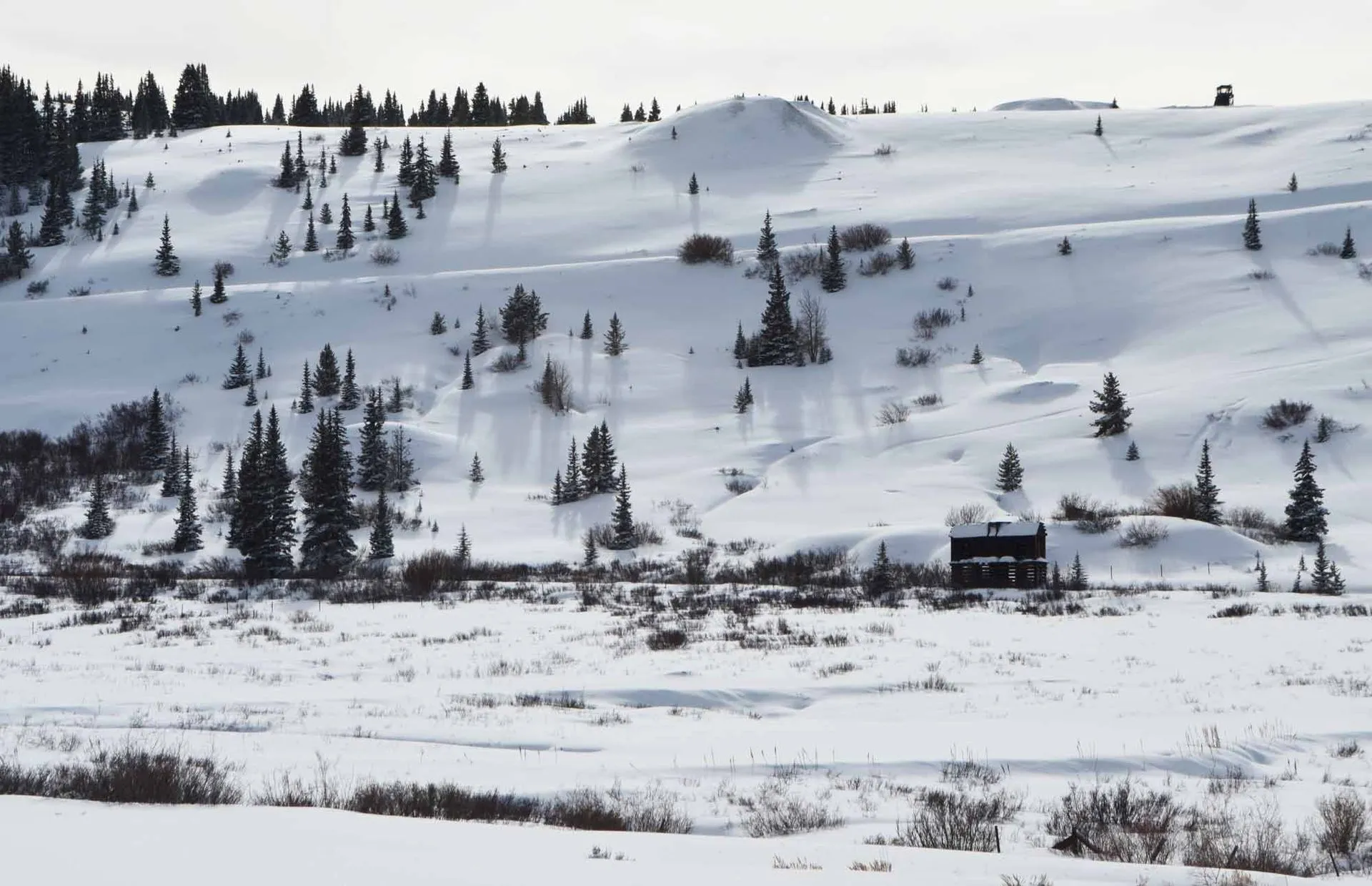
A long sloping horseshoe will bring you to the top of Breece Hill, where you’ll head west (right) on County Road 1. As you crest Breece Hill, revel in the views of 14er Mt. of the Holy Cross to the northwest and the many 12ers and 13ers from west to north to east. After you re-enter the trees and start downhill, take a hard right on County Road 38A, which comes up at a sharp angle. Bomb downhill, then turn west (left) onto County Road 38 to close the loop and return to the moderate hill that leads down to the parking area.
On the left side of County Road 38A, you’ll pass remnants of a mine on the Eliza Claim. Near the bottom of the hill and just off the road are more mining structures, near where the now-blocked St. Louis Tunnel once came out of the hillside, bringing the riches of Leadville to light.
Check our Colorado Backcountry Winter Safety Resources, especially if you are exploring off-trail in the East Side Mining District.
Want to explore this area in summer? Try the Route of the Silver Kings driving tour.